Web Maps
NYC Schools
This web portal offers a general view of the public schools in New York City. Designed to be used by parents and students, the explorer enables the viewers to see the schools location, proximity to subway, as well as basic information as is provided by the Department of Education. Schools are divided in three different layers to let users choose the school type they wish to explore. They are able to search schools by name or just to browse the map. By clicking on any school icon a pop-up window will display relevat information. Included are links to the school's web site and to the DOE's in depth information page availabe for all schools. Data is available for download and the original source can be checked.


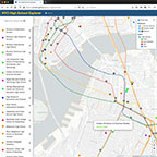
NYC High School Explorer
The New York City High School Explorer supports students and parents chosing the right public high school by offering comprehensive information based on data provided by the Department of Education, as well as a map showing location and proximity to the public transit network. The high schools are grouped into several main academic areas, such as STEM, Arts and Social Studies. To help identify schools that are a good fit, an user is able to explore the following categories: Commute, School size, Competitiveness, Performance, Learning style, Curriculum, Programs and Activities. The user can search schools by name or browse the map. Upon clicking on any high school marker on the map will bring up detailed information, including links to the schools websites and their respective pages on the Department of Education site, for even more information.


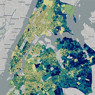
NYC Residential Zoning & Vacant Lots Map
The map provides a simple way to research vacant lots suitable for residential development and zoning regulations.


